Hike to Mount Mitsutoge, Mount Kachi Kachi & Lake Kawaguchi

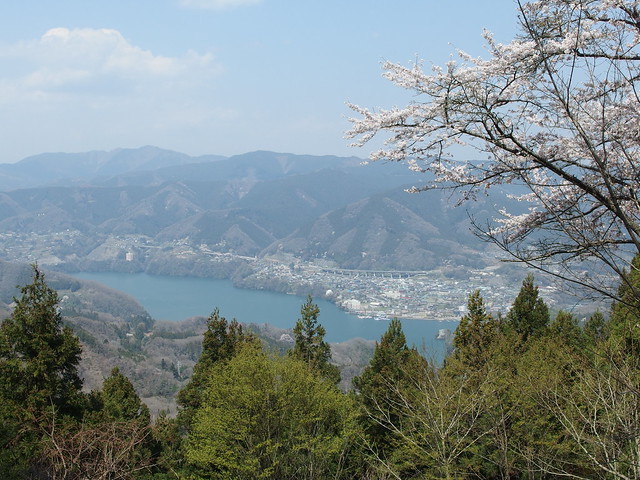
A couple of weeks ago, I went on a hike to Mount Mitsutoge (三つ峠山), in the Fuji 5 Lakes area.
A couple of weeks ago, I went on a hike to Mount Mitsutoge (三つ峠山), in the Fuji 5 Lakes area.

Mount Toyama (外山) is a mountain in Nikko. It is only a short walk (~1.5km) from the World Heritage sites, with great view on Nikko and Mount Nyoho at the summit. Here is a map of the trail.

As I mentioned in my previous post, I recently went hiking in Naguri (名栗), in Saitama Prefecture. It is a popular hiking area with many trails to choose from. For myself, I followed a trail to Ikusabata station, in Ome City (Tokyo), passing through Mount Bounoore, Mount Iwatakeishi and Mount Takamizu. Here is a map of the trail (in reverse direction).
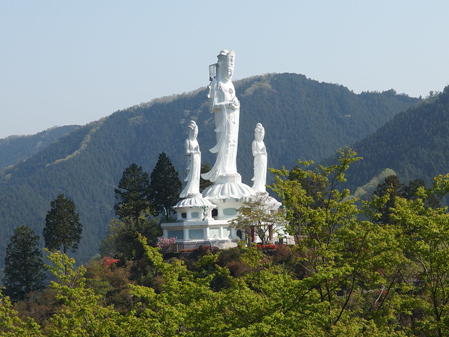
Last week, I went on a hike that started from Naguri Village, in Hanno City (Saitama Prefecture). While researching the path, I learned about the Hakuunsan Torii Kannon (白雲山 鳥居観音). It is a large park built on a mountain in Naguri, with multiple temples and monuments, the most impressive of which is the white Dai-Kannon (救世大観音 ; Guze Dai-Kannon). At 33m, it is a large statue of Kannon that can be seen from quite far. Like at the Tokyo Wan Kannon, it is even possible to climb to the head (but it was not open yet when I was there).
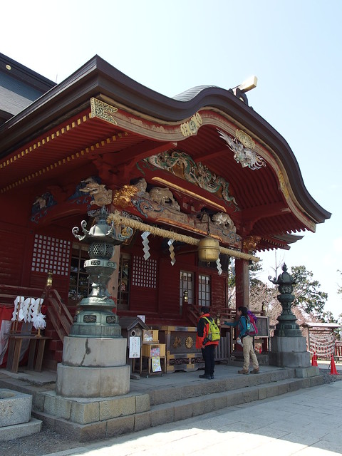
Musashi-Mitake Shrine (武蔵御嶽神社) is the shinto shrine sitting at the top of Mount Mitake. On May 7th and 8th, it will hold its annual Hinode (Sunrise) Festival.
A couple of weeks ago, I went to Okutama in western Tokyo on a hike to Mount Otake and Mount Mitake.
After getting down from Mount Sekirou and/ back at Sagami Dam, I decided to return home using the Tokyo section of the Tokai Nature Trail. It goes from the dam to Mount Shiro (城山) and Mount Takao (高尾山). I then took the lift down Mount Takao to the Keio Takaosanguchi train station.
A few weeks ago, I went on a hike near Lake Sagami, west of Tokyo in Kanagawa Prefecture. I followed a section of the Tokai Nature Trail: The whole trail covers 1,697km and goes from Mount Takao in Tokyo all the way to Mount Mino near Osaka.

After getting down from Mount Komagatake and starting from the Hakone-en Komagatake Ropeway station, I walked on the road in the direction of Moto-Hakone, at the southern end of Lake Ashi. I spent some time at the Hakone shrine and at the Hakone Detached Palace. I then took the so-called Outer Rim Trail (外輪山のハイキングコース) that follows the Ashinoko Skyline Road in the mountains west of Lake Ashi. I followed the trail until I reached Togendai, at the northern end of Lake Ashi. I arrived just in time to catch the last express bus to Shinjuku.

A couple of weeks ago, I went back to Hakone, this time for a hike to Mount Kanmurigatake, Mount Kami (神山; 1438m) and Mount Komagatake (駒ヶ岳; 1327m).