Hike to Circuit de l'Ancienne Mine & Oratoire

The Circuit de l’Ancienne Mine (Old Mine Loop) is a hiking trail in the village of Lathuile, near Lake Annecy.
The Circuit de l’Ancienne Mine (Old Mine Loop) is a hiking trail in the village of Lathuile, near Lake Annecy.

At 2,351m, La Tournette is the highest of the mountains surrounding Lake Annecy, in Haute-Savoie. It is part of the Bornes Massif.
The trail is well marked and steep but not that hard except towards the end. It starts at the Chalet de l’Aulp, in the village of Montmin. However, there is no public transportation to get there. So after poring over maps and looking on the internet, I settled for taking the same path I used when I went to Pointe de la Rochette: I first rode my bike to Verthier, at the southern end of the lake, then took the forest trail up to Col de la Forclaz and, finally, walked past Pointe de la Rochette to reach the Chalet. An alternative would have been to start in Talloires and go through Col des Nantets on the way to the Chalet.
Update 2017: There is now a summer shuttle from Talloires to Col de la Forclaz and the center of Montmin. It doesn’t arrive exactly at the Chalet but gets you closer.
Update 2021: The bus lines mentioned above to Col de la Forclaz and Montmin are now operated by SIBRA, the operator of the Annecy bus network: SIBRA lines F1 and F2. They now operate on the week-ends of June and September, as well as every day in July and August. They remain free.
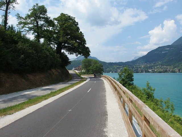
The Lac d’Annecy (Lake Annecy) is located in Haute-Savoie and is the third largest lake in France. In spring, I took my bike on a loop around the lake. The loop is about 42km and should take about 3 hours to complete in one go. Starting in Annecy-le-Vieux, I first followed the road southwards on the eastern shore of the lake and stopped at Roc de Chère, Cascade d’Angon and Réserve Naturelle du Bout du Lac. It started raining heavily at that point so I rushed to go back to Annecy. However, the western shore of the lake is actually the nicest for cyclists, with a flat and fully separate bike lane (Voie Verte), which goes all the way from Annecy to Albertville. I used photos from other times I was on that path instead.

The Réserve Naturelle du Bout du Lac is a nature reserve located in the marshland at the southern end of Lake Annecy, where the Ire and Eau Morte rivers flow into the lake. The park has trails for pedestrians and horse riders, as well as viewpoints on the lake. There are also beavers in the rivers but I did not see any during my visit. Unfortunately, it started to rain pretty hard while I was there so I had to rush a bit.

After the Roc de Chère, I continued on my loop around Lake Annecy: My next stop was the center of the village of Talloires. The short path to the so called Cascade d’Angon (Waterfall of Angon) starts there. The waterfall is at the end of a slippery trail carved in the rock. I then kept going up, in the direction of the Ermitage de Saint-Germain. Saint Germain was a monk who founded the abbey of Talloires, on the shore of Lake Annecy, in the 11th century. The ermitage is a church built on the location where he used to come for retreat. There is also a great view on the lake from there. I then went back down to Talloires.

The Roc de Chère is a national nature reserve in the village of Talloires, on the eastern bank of Lake Annecy. I went there by bike from Annecy, while doing a loop around the lake. There are many trails in the forest and a few viewpoints on the lake.

Pointe de Banc Plat is a peak located at the south-west of Lake Annecy in the Bauges Massif. The area around it is known as Montagne du Charbon. The summit has a great view on the Bauges and the mountains around the lake. This page has the itinerary that I tried to follow: After the summit, instead of taking the ridge to Dent des Portes, I actually went back on the same path as the one I took on the way up.

The Taillefer (in the foreground on the photo above, taken from the Ermitage de Saint-Germain) and the Montagne d’Entrevernes (background) are mountains in the Bauges Massif, on the western shore of Lac d’Annecy. This page details an itinerary similar to the one that I followed (except that, at Col de la Cochette, I stayed on the ridge instead of going down on the other side).

Mont Veyrier dominates the north-east side of Lake Annecy. This article describes the itinerary that I followed.
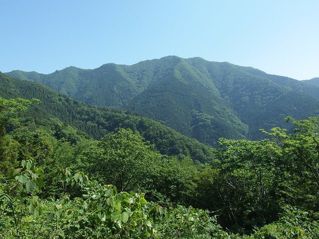
For my last hike in Japan, I went back to the Lake Sagami area. I went to Mount Mikuni, Mount Shoto and Mount Jinba, basically following this itinerary, except that I took the bus at the beginning.