Hike to Mont Baron & Mont Veyrier: From Col de Bluffy to Annecy-le-Vieux

In the fall of last year, I went on a hike to Mont Baron and Mont Veyrier, this time starting from Col de Bluffy and arriving in Annecy.
In the fall of last year, I went on a hike to Mont Baron and Mont Veyrier, this time starting from Col de Bluffy and arriving in Annecy.

The Bois des Glaisins is a park in Annecy-le-Vieux. It has an easy walking trail in the forest and along Ruisseau des Fées (a small stream).

The railway line from Annecy to Albertville started operating in 1901 and closed to passenger traffic in 1938. Freight traffic kept running until 1964 when it shut down for good. In 1975, parts of the line on the west side of Lake Annecy were converted into a bike path: The Voie Verte du Lac d’Annecy. More of the line (until Ugine, near Albertville) was converted later in 2005. However, some of the rails in Annecy, west of the train station until a bit before Tunnel de la Puya (under the Semnoz), still remain. There is also a section of abandoned tracks in the Zone Industrielle de Vovray that used to be connected to the old Annecy-Albertville line.
I walked alongside those train tracks last fall: First, I walked from the train station to the ends of the train tracks in Vovray. Some parts were fenced off so I had to walk around. Some other time, I went back to the place where the line branched off towards Albertville and followed its course until Tunnel de la Puya, which was walled off. I walked on the Semnoz to get to the other side, in Sevrier. The exit of the tunnel was still open. I walked a little in the tunnel from there, but it was pretty dark so I didn’t go very far.

Last fall, I walked from Poisy to Cran-Gevrier near Annecy, passing through Gorges du Fier, Parc Altaïs, Parcours Nature Fier et Erbe and Cercle de l’Eau.

My new book is out and is available on Amazon! It was self-published through Amazon KDP and is called: 25 randonnées autour du Lac d’Annecy - Accessibles en transport en commun (25 hikes around Lake Annecy - Accessible with public transport). I finally received a proof copy yesterday (it took a while…) and I am pretty satisfied with how it came out.
Here is a sample PDF with a few hikes: Sample PDF. Also check out the companion web page for the book, with GPS tracks for download, as well as links to additional photos and alternate routes for the hikes.
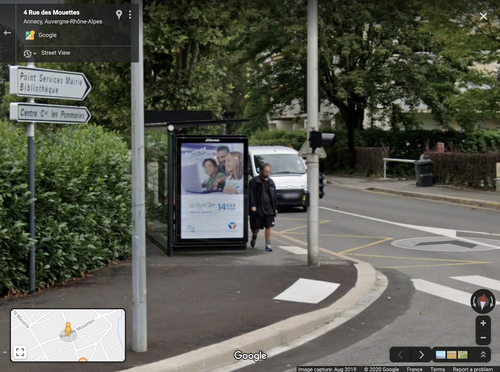
Last summer, while I was walking around in Annecy-le-Vieux, I saw a Google Street View car doing its thing. Since then, every couple of months, I had been checking that location on Google Maps for an update. After more than 6 months, it was finally updated recently and I am now officially on Google Street View! I appear on 3 photos.
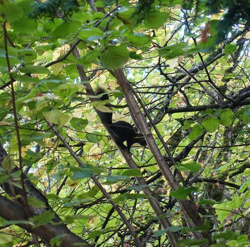
I saw this squirrel today in Parc des Raisses in Annecy-le-Vieux. Not sure what specy it was but it was squeaking pretty loud. It was my first time seeing a squirrel in the city, although I see them sometimes in the forest.

The Église Sainte-Geneviève des Bressis is a catholic church located in the Cran-Gevrier neighbourhood of Annecy. It was designed in the modernist style by architect Paul Jacquet and was completed in the 1960’s.

“Annecy Paysages” is a yearly open-air festival featuring artistic and live plant installations by landscape architects, visual artists and architects who reinterpret the city’s open spaces. Just like the first edition last year, it takes place in the center of Annecy until the end of summer. Here is a map of all the artworks and the PDF brochure.

At the beginning of spring, I went on a hike to Mont Baret, a mountain located on the north-east of Lake Annecy, between Mont Veyrier and Col de Bluffy.