Hike around Pointe de Chenevier
In early spring, I went on a hike around Pointe de Chenevier, a mountain opposite Pointe de la Rochette on the other side of Col de la Forclaz.
Here is a map of the path I walked (download KML):
In the morning, I took a LIHSA bus (51 line) from Annecy and got off at the “Giez Gare” bus stop. I walked north towards Vesonne and the hamlet of Mont Bogon above, where I found a forest trail. It went up to Col de la Forclaz using a path on the west side of Pointe de Chenevier. At the Col, I kept going up until the takeoff area for paragliders. There was a great view on Lake Annecy and the Bauges. I had lunch then went back down to the Col. From there, in order to loop back to my starting point, I walked on the east side of the Pointe, following a dirt road for a while. I found a viewpoint, Belvédère du Rochet Chenalet, with a really good view on Lake Annecy and the Réserve Naturelle du Bout du Lac. After that, I took a steep trail down that got me back to Mont Bogon. Finally, I waited for the bus to Annecy.
Above, LIHSA bus stop.
Above, towards Montmin.
Above, Dent de Cons and Belle Etoile.
Above, Pointe de Chenevier.
Above, Pointe de Vélan on the other side of the valley.
Above, Montagne du Charbon.
Above, Vesonne.
Above, trail to Mont Bogon.
Above, donkeys in Mont Bogon.
Above, forest trail.
Above, after a while, the path is no longer marked on the official IGN map but it is still easy to follow.
Above, ruins of a chalet at Plant du Suit.
Above, Pointe de Chenevier from the trail to Col de la Forclaz.
Above, first view of Lake Annecy.
Above, the path is quite narrow at times.
Above, at Col de la Forclaz. It is also accessible by road. It offers a great view on the lake and can be quite crowded.
Above, view of Lake Annecy from the Col.
Above, stone quarry of Taillefer.
Above, Oratoire de Saint-Roch.
Above, mountains below La Tournette.
Above, pedestrian path to the takeoff area for paragliders.
Above, Roc de Four Magnin and Roc des Boeufs, in the Bauges.
Above, Pointe de la Rochette.
Above, looking back at Col de la Forclaz and Pointe de Chenevier, with the Bauges in the background.
Above, hang gliders.
Above, paragliders waiting to be cleared for takeoff. There had been a crash soon before I arrived and a rescue helicopter was due to arrive soon.
Above, area for spectators.
Above, Château de Châteauvieux in Duingt.
Above, rescue helicopter.
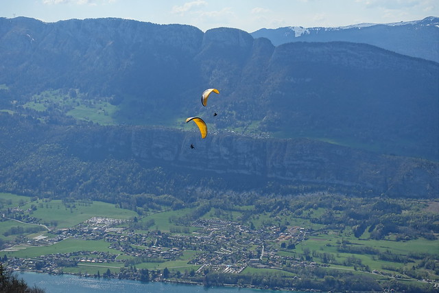
Above, duo of paragliders taking off. Col de la Forclaz is a popular takeoff place for trying out paragliding in tandem with an experienced guide.
Above, Mont Baret and Mont Veyrier.
Above, Roc de Chère.
Above, on the way down to Col de la Forclaz.
Above, Crêt des Mouches and Pointe de Banc Fleury.
Above, on the way back.
Above, La Tournette.
Above, Montmin.
Above, Pointe de la Rochette.
Above, telecom antenna camouflaging as a tree.
Above, view from the Belvédère du Rochet Chenalet.
Above, Réserve Naturelle du Bout du Lac.
Above, steep trail to Mont Bogon.
Above, the horses are still grazing.
Above, back at Mont Bogon.
Above, flag of Savoie.
Above, Vesonne and Pointe de Vélan in the background.
Above, Dent de Cons and Belle Etoile.
Above, watching the cows while waiting for the bus.


