EU elections: Get out the vote video
From Sweden, DJ Trexx : A Union of Peace, Love and Bass. Glorious!
From Sweden, DJ Trexx : A Union of Peace, Love and Bass. Glorious!

I had been trying to get into iPhone / iPod Touch application development for some time, but I was just too lazy until I bought a few weeks ago an iPod Touch (which I really like - I am playing the Sudoku game from Mighty Mighty Good Games all the time).
![]()
The new version has been released a few days ago. There does not seem to be anything earth-shattering in the update, according to the release notes and my own experience with it. Just a few corrections here and there and more samples in the documentation. I have been using version 1.0 of the API since it got out of beta in October last year and I have enjoyed it very much. It may also have something to do with the fact Flex can be much less frustrating to work with than the HTML + JavaScript combo.
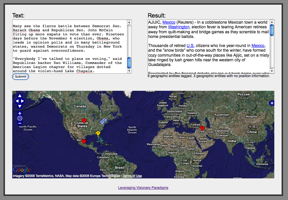
This tutorial will show how to use version 3.1 of the Calais API to identify geographic references in a text and display them on an OpenLayers map. I am going to use the Calais API with JSON output (which is a new feature of version 3.1), so that all the processing can be done easily in JavaScript entirely inside a web browser.

Street Views have now been added to some French cities, including Paris. The coverage there is pretty good, with parts of the suburbs as well as the main Paris city currently visible. The other cities include Lyon, Marseille, Lille, Nice and Toulouse.
Above, the Panthéon, in Paris.
From the Stanford Testbed of Autonomous Rotorcraft for Multi-Agent Control (STARMAC) project.
Absolutely incredible!


