Pays de Gex
Last saturday, I went for a bicycle ride in the Pays de Gex, where I live. I took a few pictures. Some are shown after the jump.
Last week, on the day of the “Jeûne Genevois”, I went for a ride along the Rhône following (loosely) the route known as Via Rhona, that goes from Geneva to the town of Valleiry in Haute-Savoie (actually it is just a segment: The complete Via Rhona goes from the Rhône Glacier to the Mediterranean Sea) . I had already tried it before but I was not able to finish it then. Now I went all the way and, although it was quite cloudy with occasional rain, I had a great time.
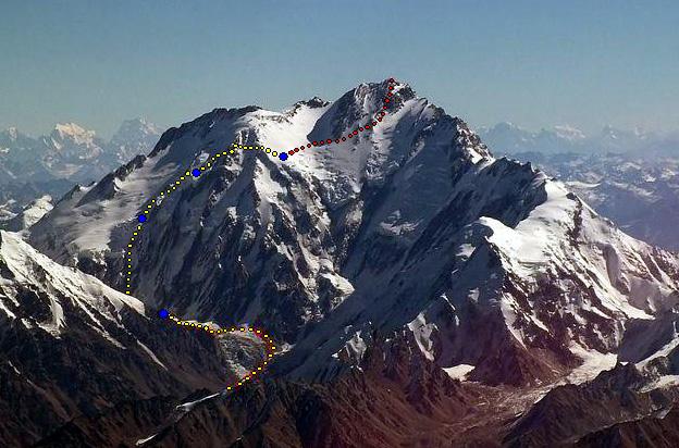
I received some time ago a complimentary copy of the Canadian Alpine Journal where I had a (very) small contribution : a photo of the Diamir face of the Nanga Parbat that I took back in 2005. It is part of an article by alpinist Louis Rousseau giving an account of the Austro-Canadian attempt at the Nanga Parbat through a new route. I haven’t found the article online but there is another version on the American Alpine Journal blog.
I recently bought a new Windows computer and, since there is no AppleScript on Windows, I have to do without the Doug’s scripts for ITunes that I used on Mac OS X to automate the management of my music library. But Apple has made available a COM API, that can be used by any language to script iTunes, as long as it supports COM. This includes Ruby MRI, with the Win32OLE package in the standard library. But I was curious about IronRuby, the .NET implementation of Ruby, which recently reached version 1.0 and therefore, I decided to reimplement with it some of the scripts I used the most.
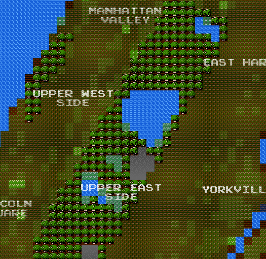
Very cool 8-bit map of New York City. More details about this project can be found here.

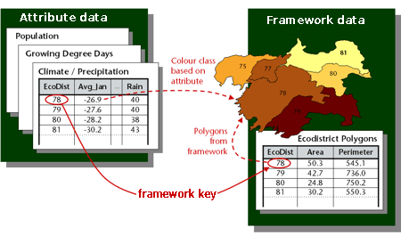
I have recently learned about an upcoming OGC standard that looks interesting: The Table Joining Service (formerly known as the Geographic Linkage Service or GLS). It standardizes a solution to the very common problem of mapping statistical data that is geographically related but maintained outside a GIS. To do that, the service uses a key (for example, a country or zip code) common to the statistical dataset and a geographic dataset providing the geometries.