Hike to Mont Bisanne

Last fall, I went on a hike to Mont Bisanne, in the Beaufortain mountains. I went there by car with my father, but in summer, it is also possible to get there with the Navettes natures Beaufortain.
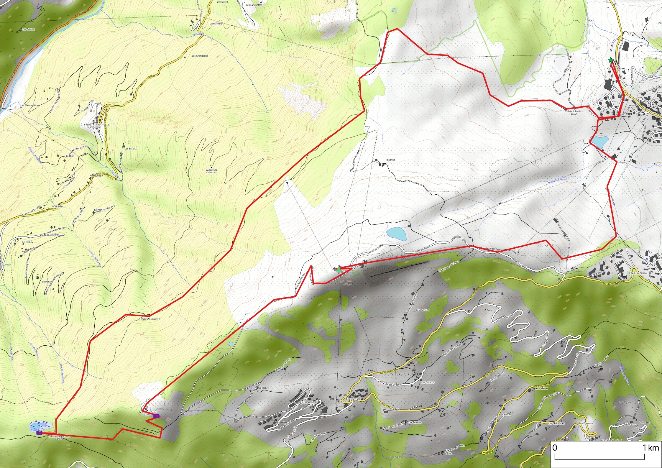
Here is a map of the path I walked:
- Download path KML
- Download large map
- More photos on Flickr
- Day of the hike: September 19, 2025
In the morning, passing through the Beaufort valley, I went by car from Annecy to the resort at Col des Saisies (Parking du Signal), below Mont Bisanne. Instead of taking the direct way up to the summit, I first walked to the other side of Mont Bisanne, reaching Lac des Saisies and La Croix de Coste. On the way, there was a great view on the Aravis mountains. I then followed ski tracks to reach the summit. Finally, I went down to the resort directly from there. To get back to Annecy, I passed through Flumet and Col des Aravis.

▲ Mont Bisanne seen from Parking du Signal.

▲ Aravis.

▲ On the path to La Croix de Coste.

▲ Bornes.

▲ Mont Charvin.

▲ L’Étale.

▲ Sentier de la Salamandre to Lac des Saisies.

▲ Lac des Saisies.

▲ Combe de Savoie towards Grenoble.


▲ Cross at La Croix de Coste.

▲ Mont Blanc.

▲ Mont Bisanne.

▲ La Tournette.


▲ Antennas at the summit of Mont Bisanne.

▲ Roche Parstire and Pierra Menta.


▲ There was a meeting of racing car enthusiasts from the Netherlands near the summit.

▲ View towards Col des Aravis from the summit of Mont Bisanne.

▲ Towards Ugine.


▲ Mont Charvin and Aiguille du Bouchet.

▲ Restaurant near the summit.

▲ Valley of Beaufort.


▲ Mont Blanc.

▲ Towards Cormet de Roselend.

▲ Montagne d’Outray.

▲ Getting back to the resort at Col des Saisies.
