Hike to Mount Takahata & Mount Kuratake
In May, I went on a hike to Mount Takahata (高畑山) and Mount Kuratake (倉岳山), in Yamanashi prefecture.
Continuing the spring hike to the Tanzawa Mountains. Check Part 1 for the map of the path. This is essentially the same path as for the hike to Mount To and Mount Tanzawa, except in the other direction.
In May, I went back to the Tanzawa Mountains, in Kanagawa: I hiked Mount Oyama, Mount Sannoto and Mount To.
In May, I went to Maebashi City in Gunma Prefecture, north of Tokyo, in order to visit Mount Akagi (赤城山). There is no actual peak named “Mount Akagi”: It refers to the whole mountain range in the area. Its best-known attractions are Akagi Shrine, Lake Onuma (大沼) and Mount Kurobi (黒檜山). While I was there, I took a series of trails going through some of the peaks surrounding the lake. This page can serve as a reference (although it differs a bit from what I did).
Continuing the hike from Hinohara Village to Lake Okutama. After Mount Mito, I stayed in the Tokyo Citizens’ Forest (Tomin-no-Mori) and went down towards Mito Waterfall then continued to Lake Okutama. Check Part 1 for the map.
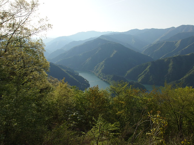
A few days after my hike to Mount Usuki and Mount Jinba, I went back to Hinohara Village: This time, I took the trail to Mount Sengenrei (浅間嶺). After the summit, I kept walking on the Sengen Ridge (浅間尾根) until I reached Hinohara Tokyo Citizens’ Forest (檜原都民の森; Hinohara Tomin-no-Mori) and Mount Mito (三頭山), which I had already climbed starting from Lake Okutama. After that I went down to the Visitor Center, enjoying the Forest Therapy Road and the sight of the Mito Waterfall (三頭大滝; Mito Otaki). When I set out in the morning, I had planned to stop there but there was still a bit of time before sunset so I decided to keep going all the way to Lake Okutama (奥多摩湖), going up again through Mount Toishi (砥山) and Mount Tsukiyomi (月夜見山) before going down to the lake through the camping grounds of the Mountain Hometown Village (山のふるさと村; Yama-no-Furusato Mura). I then crossed the lake at the Floating Bridge (浮橋; Ukihashi) and waited for the bus on the other side.
After visiting the Hossawa Falls, which was actually a detour, I turned east to reach Mount Usuki (臼杵山) and continued to Mount Ichimichi (市道山). Those are two of the “Three Togura Mountains” (戸倉三山). After Mount Ichimichi, I walked south to Mount Daigomaru (醍醐丸) then went down to Wada Pass (和田峠) before climbing the stairs leading to the summit of Mount Jinba (陣馬山). I then walked part of the trail to Mount Takao but went down the mountain at Myo Pass (明王峠) in the direction of Lake Sagami (相模湖), passing Yose Shrine (与瀬神社) along the way. I then took the train back to Tokyo from Sagamiko station.
The Hossawa Waterfall (払沢の滝; Hossawa-no-taki) is located in Hinohara Village, in western Tokyo. It is only about 10 minutes from the bus stop, next to the trailhead to Mount Sengenrei. This page has a map and directions to its location.
A couple of weeks ago, I went on a hike to Mount Mitsutoge (三つ峠山), in the Fuji 5 Lakes area.
Mount Toyama (外山) is a mountain in Nikko. It is only a short walk (~1.5km) from the World Heritage sites, with great view on Nikko and Mount Nyoho at the summit. Here is a map of the trail.