"Freehand Raster Georefencer" plugin for QGIS
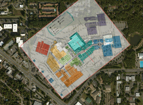
Some time ago, I released a plugin for QGIS called “Freehand Raster Georeferencer” that allows interactive raster georeferencing. It implements some tools (move, rotate, scale, stretch…) to manipulate a raster directly on the map, on top of the other layers. This is in contrast with the standard raster georeferencing tool of QGIS, which needs control points and then an export to be able to check the georeferencing.
Once the georeferencing is satisfactory, it is possible to export a new raster with a world file and then import it into QGIS in order to use all the available raster analysis tools.
The plugin has 2 main limitations:
- The lack of support for all the GDAL raster formats: The plugin actually implements its own raster layer that uses Qt to perform reading and only some raster formats are supported (BMP, JPEG, PNG, TIFF)
- It only supports affine transformations (without shearing) and not the full set of transformation algorithms (including rubbersheeting) the standard QGIS georeferencer provides
The code is opensource and on Github. Here is some documentation on the tools.
