Hike around Lake Onuma at Mount Akagi
In May, I went to Maebashi City in Gunma Prefecture, north of Tokyo, in order to visit Mount Akagi (赤城山). There is no actual peak named “Mount Akagi”: It refers to the whole mountain range in the area. Its best-known attractions are Akagi Shrine, Lake Onuma (大沼) and Mount Kurobi (黒檜山). While I was there, I took a series of trails going through some of the peaks surrounding the lake. This page can serve as a reference (although it differs a bit from what I did).
Here is a map of the path I walked (download KML):
Starting from the bus stop near Lake Onuma, I first headed south to Kakumanbuchi marsh (覚満淵). I then went up Torii Pass (鳥居峠) before taking an alternate trail to Mount Komagatake (駒ヶ岳) and then on to Mount Kurobi, the highest point in the area. I then went down to the lake and visited Akagi shrine. Next, I walked on the lakeside path northwards to reach the trailhead to Mount Jingasa (陣笠山), near the campgrounds. I then followed the ridgeline until Mount Debari (出張山), after which I headed back to the lake and followed the paved road until the start of the trail to the viewpoint at Mount Miharashi (見晴山), which I visited next. I then made my way to the summit of Mount Jizohdake (地蔵岳) and went down on the other side to reach Lake Konuma (小沼). My last mountains of the day were Mount Choshichiro (長七郎山) and Mount Kojizohdake (小地蔵岳). I finally went back to Torii Pass and then on to the Visitor Center to catch the bus back to Maebashi City.
Above, at Oku station in Kita City (Tokyo), catching the first train of the Takasaki JR line. I then transferred at Takasaki for Maebashi.
Above, waiting for the bus in front of Maebashi station.
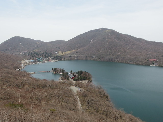
Above, Lake Onuma, looking at the red bridge of Akagi shrine.
Above, Kakumanfuchi Marsh, with Mount Kojizoh in the background.
Above, view from Torii Pass.
Above, start of the trail (unmarked at the beginning) to Mount Komagatake.
Above, view from the summit of Mount Komagatake.
Above, torii and shrine near the summit of Mount Kurobi.
Above, rest area north of the summit of Mount Kurobi.
Above, on the way down to Lake Onuma.
Above, Akagi shrine seen from the trail.
Above, Akagi shrine.
Above, on the lakeside path.
Above, on the way to Mount Jingasa.
Above, view from the summit of Mount Debari.
Above, back at Lake Onuma.
Above, on the way to Mount Miharashi.
Above, access road seen from the summit of Mount Miharashi.
Above, on the way to Mount Jizodake.
Above, antennas at the summit of Mount Jizodake.
Above, Lake Konuma.
Above, Chi-no-Ike (血の池), literally Blood Pond. I thought it would have more red and be a pond…
Above, at Lake Konuma.
Above, on the trail to Mount Choshichiro.
Above, summit of Kojizohdake. I saw a deer there but it fled before I could take a picture.
Above, back at Torii Pass.


